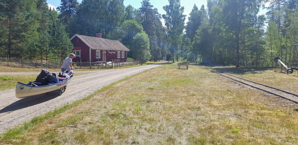
Stage 10 starts in Tvetaberg and ends in Järna. The route is 12 km long and on this tour we ended a bit short of Järna, at Kallfors to be more precise. The first km of the stage is not too interesting. The route is along a road and there is quite much houses along the way. But eventully you reach the forrest and get both views and lakes.
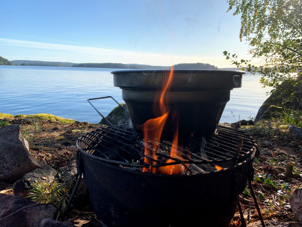
We made camp at Vaskasjöarna at a really nice spot. The rest of the day we relaxed and took care of the fire which needed much attention since it had been raining for a couple of days. The hunting season had started and we heard rifle shoots going of a couple of times.
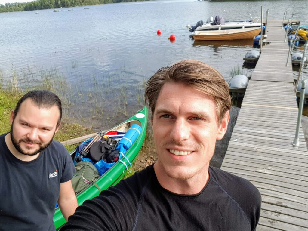
Some adventures are planned for a long time while others happens just because an opportunity arise. This is one of those unplanned trips that happen just because you got some unexpected time over and access to a canoe in Rimforsa.
So we knew that we would start in Rimforsa but wasn’t sure where we would end. We found info that there is a canoe trail that passes Rimforsa but in the opposite direction that we were planing. Couldn’t find any good info about how strong the current is in the parts that consist of rivers but from the look of it from google map it looked like it should be ok. If not then we just had to change the plan., no problems.
We got a late start the first day and just paddled on to cover as much distance as possible the first day. In late September the sun sets around 19.00 and it is dark around 30 minutes later so you really notice the shorter days now compared to the summer. Got ourself a nice camp on a small island in the rather big lake of Åsunden where we spent most of this trip on.
When we woke up the next morning we woke up to more or less summer weather. The sun was warming and, at the beginning, almost no wind. Conditions couldn’t become much better especially at this time of year when the autumn really starts to take its grip over Scandinavia. When we started paddling the wind started to pick up but we had the wind in our back so it just made our day even easier. We realized that the lake Åsunden was larger than we had anticipated and it took us quite some time before reaching the small city of Horn were we had to do our first lift. On the other hand we didn’t stress and had some nice breaks and even a swim.
At Horn there was a local store so one could fill up supplies and water here if needed. With a canoe wagon the lift would be extremely easy since it was a gravel road but we had to carry the canoe. From here the paddling is mainly on the river of Stångån and a few connecting lakes. I feel that paddling on rivers have a tendency to be more rewarding than the big lakes since there is more to rest your eyes on and you get the feeling that you are moving forward faster. And it is more exiting since you don’t know what is going to be around the next corner.
It was harder to find a campsite than expected and suddenly we found our self still in the canoe after sunset and nowhere to camp. We picked up the pace and just when we needed it at most we wound an island that worked. When the tent was up it was almost pitch black so it was really in the last minute.
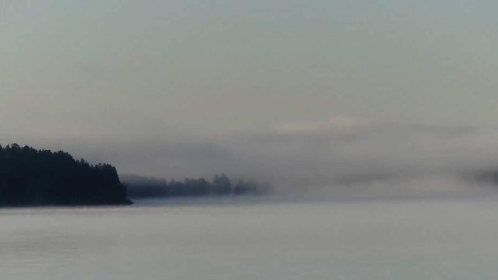
In the morning we woke up to another beautiful day with some light fog over the water. This was our last day and we needed to get an early pick up since normal life was calling so we got ourself an early start and started paddling. The weather shifted to the worse just to shift back again to become really nice.
We didn’t made it all the way to Vimmerby which was sort of the plan but it wouldn’t been any problem if we have had the full day paddling. We ere very happy with this trip were everything had worked in our favor. It shows that having a piece of the Scandinavian wilderness doesn’t need to be hard or well planned. Sometimes all you need is some time over and a canoe.
Sörmlandsleden is one of Swedens longest walking trail. The trail starts at the subway station in Björkhagen, Stockholm, and then make a loop in the Swedish county of Södermanland. The main loop is around 620 km long but with alternative and connecting routes the entire trail is around 1000 km. Sörmlandsleden is a popular choice for day trips or shorter overnight trips. It is an easy way to explore the nature around Stockholm. The trail is usually easy accessible and it is well marked so walking and camping along the trail is quite easy.
This tour was starting at stage 12 and walking towards stage 11. More information about the trip is provided in the video below.
The largest city in Scandinavia may not be associated with wilderness experience but Stockholm does have a lot to offer when it comes to nature experience. As an example, the Stockholm archipelago consists of around 24000 islands. This makes the Stockholm archipelago a paradise for kayaking.
Too much to read? Watch the video instead.
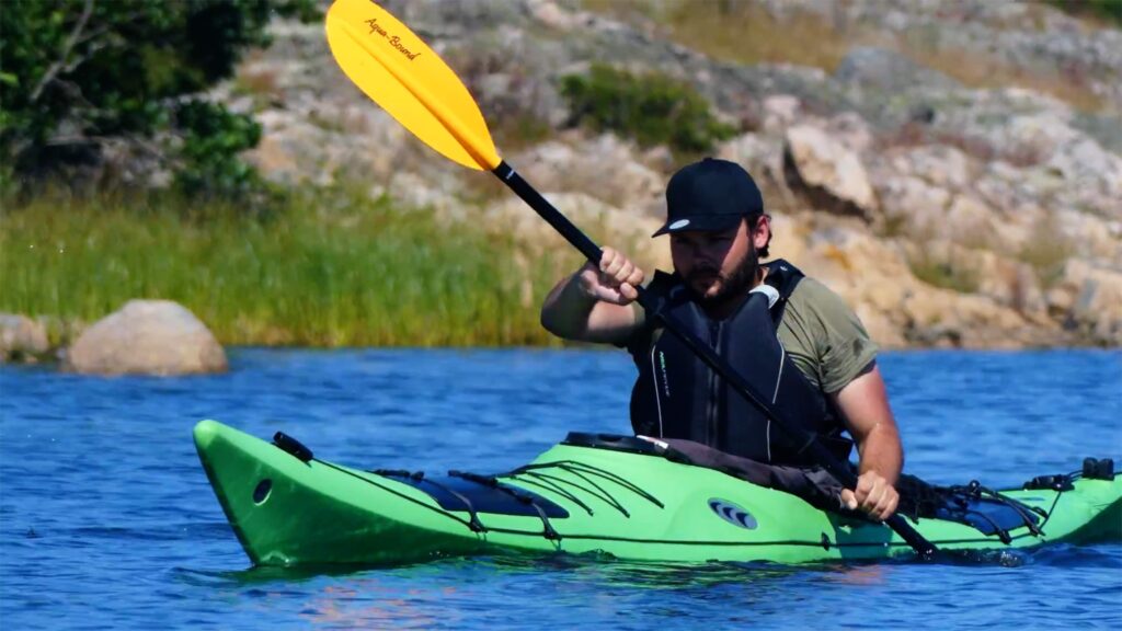
I have spent a lot of time in the archipelago. We have a summer house there so more or less every summer for 35 years. But i have never tried a kayak before and have explored just a fraction of the archipelago. Finally i took the time to go on a 4 day kayaking tour and see what more the archipelago has to offer. With me on the trip is my friend Elias. He is the type who typically avoid sleeping in tent but he has former kayaking experience. So on the trip there is two beginners. One beginner on the kayak and one beginner camper.
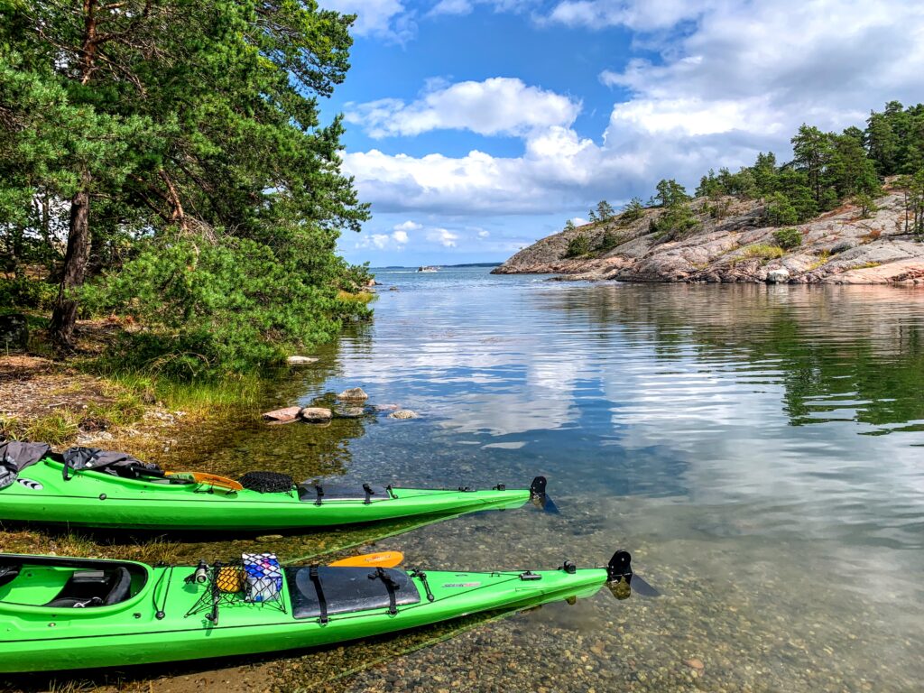
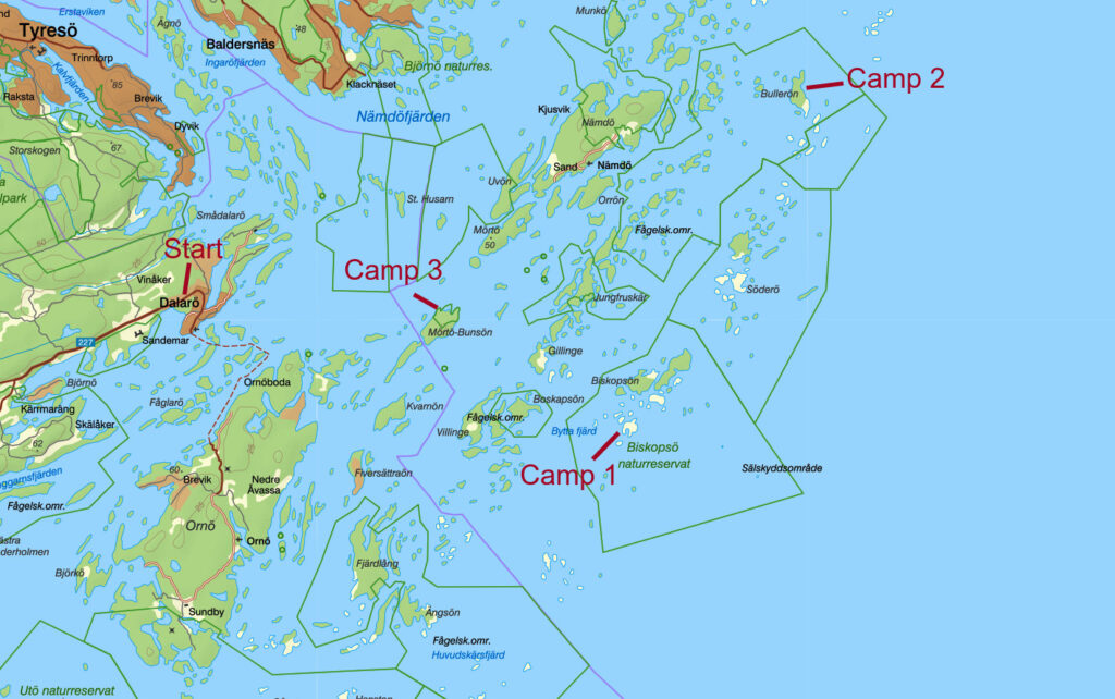
We started this trip on Dalarö were we hired our kayaks. Dalarö is a good starting point since it is easy to access by car but still gets you out in the outer archipelago fast. After a quick demonstration how things work its just to hop in and start the trip. As a beginner i was surprised how quickly i felt comfortable in the kayak. It felt stable and very comfortable.
Our plan was to get as far out in the archipelago as we could the first day. During the whole trip we were lucky with the weather and especially the wind. We were doing some larger crossings or at least larger in the context that it was my first day in a kayak. If it would have been windy some of this crossings could have given us problems.
This trip was made in late July and this means that most swedes are on holiday and the archipelago is a popular holiday destination. Even though there are lots of boats out there it’s no problems finding your own little island to set up camp on. This is extra easy when using the kayak since there is so many small coves and likes that normal boats can’t go in while the kayak just gently passes through.
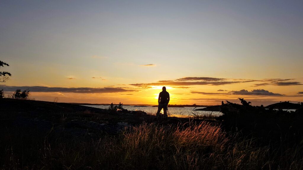
Sunset at camp 1
First night we ended up at an island called Finnskär, or perhaps Byttan, depending which map one uses. We were quite tired and didn’t stay up all to late. If one would head straight east, towards the open sea, you would reach one of Stockholm archipelagos largest seal colony. At this time of year it is forbidden to approach this colony but after 15th of August one can paddle out and greet the seals. They are quite curious and come up next to the canoes.
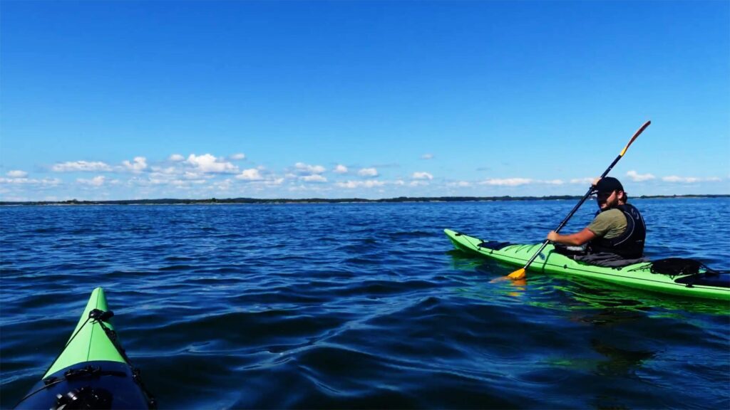
The morning after we woke up to a new day with perfect weather condition. Sunny and almost no wind at all, but this would become even better. We aimed towards Bullerö which became our final destination this day. This also meant we had the wind in our back the entire day which made the paddling very easy. We didn’t find any good information were we could fill up our water but aimed for Långvikskär which would be a good candidate. We did find a well we could use but later realized that we could have waited until we reached Bullerö.
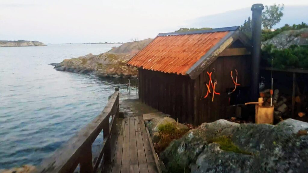
Bullerö is part of a nature reserve, which a large part of the archipelago is. There is some facilities like a cabin, water and outhouses. And there was a sauna which is open for everyone to use. This made us set up camp here, even if it violated the original plan to avoid other people. There is a designated area for setting up tents and you are encourage to stay there. Didn’t quite understand the rules but think you still were allowed to put up the tent anywhere you want on the island under the freedom to roam. The evening was spent in the sauna and swimming in the ocean and later around the campfire with some of the other campers that we met.
The free to use sauna at Bullerö
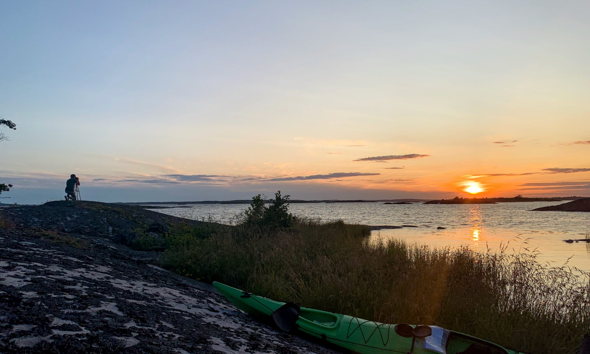
The next day we once again woke up to perfect weather. This was our last whole day and it was time to start heading back towards mainland. This became one of the nicest paddling days where we had both large crossings in perfect conditions and parts with lots of small islands. We ended up on a small island just next to Mörtö Bunsö. We put camp up a bit in the woods but spent the night out on the rocks watching the sunset.
Next day started as previous days. Nice weather, breakfast, coffe and a swim. Only 10 km between the end of our kayak adventure and normal life back on mainland. I was surprised how much i have enjoyed kayaking. I thought that it might be a bit boring at times but i enjoyed every second of it.
Some lessons learned until next kayak adventure. First is the timing. Even though July is our warmest month i think that this trip may be best suited for late August. At least if you want to be on your own. There are many boats out in the archipelago but as soon as school and work start, the archipelago drains from people. Also, the nights are once again dark which can offer some amazing night skies.
Be aware of the sun and wear sunscreen otherwise it can be a painful trip. Try to organize your gear in small water tight and transparent bags which makes packing the kayak much easier. Last, you are best out with a self supporting tent since there is a big chance you will camp straight in the rocks. And because of that, a comfortable sleeping mattress is also recommended.
As a young boy growing up in Sweden i always heard about all the nature we have in Scandinavia and the Nordic country’s. While being a kid i liked being outdoors and nature but most of my dreams where in far away places, like coral reefs in Australia or rainforests in the Amazons. I just didn’t feel Sweden was too exotic and cool. But things change. Trying at least some of my former dreams priorities have now changed and today other values matter more.
Now i really like being out in the wild. It doesn’t have to be instagram friendly or extreme in any way. Just me and nature. That’s enough. Luckily we have plenty of that in Scandinavia.
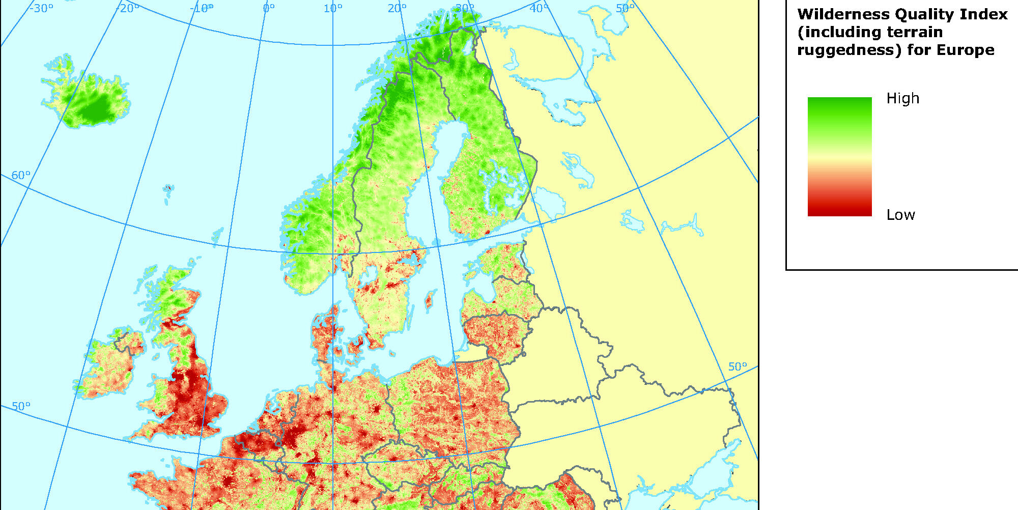
I tried to find something that shows how wild Scandinavia and the Nordics are. And that made me find the Wilderness Quality Index. This is a index provided by the European Environment Agency (EEA) which is an agency of the European Union. They describe there purpose as “provide sound, independent information on the environment”. It is clear that the adults telling me about all the nature we have at home were right.
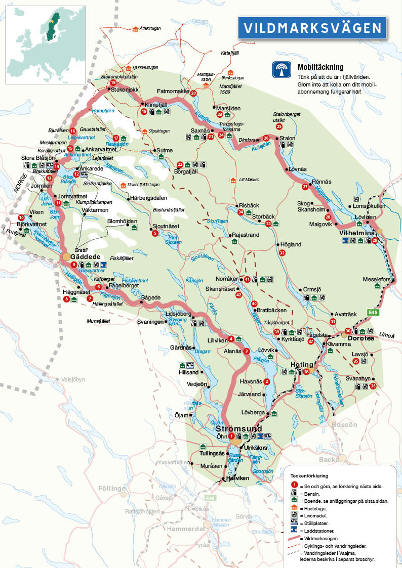
The wilderness road (vildmarksvägen) is a great way to explore the Swedish wilderness without even leaving you car. It is therefore safe to say that this is some easy accessible wilderness. The road starts in Strömsund in Jämtland and heading west towards Stekenjokk. The highest part of the road towards Stekenjokk goes over bare mountain and is only open during the beginning of June to the end of the October. The rest of the year this part of the road is covered in snow. It can be quite spectacular to drive here at the beginning of the season when there are high walls of snow alongside the road.
The road ends in Vilhelmina which may be poorly worded since you might just as well go the other way around. You can also take the inland road between Strömsund and Vilhelmmina which makes the wilderness road a roundtrip. If decided to make the full loop then expect to cover around 500 km.
There is not to many places in Sweden where you can reach the bare mountain so easily. Here the reindeer graze and the arctic fox hunts. There is plenty to see and explore along the road. Visit Bjurälven nature reserve or the waterfall Hällingsåfallet just to mention a few.
Some say that planing a trip is half the fun. I’ll don’t know if it’s half the fun but it sure is rewarding to set the plans and have something to look forward to. When planing a trip into the wilderness you inevitably have to look at a map at some point. Today this is easy done using Google Maps or some other map service. Especially with the satellite filter you can get a pretty clear idea on what to expect.
But there is always good to have access to a detailed map especially when you actually are out on the excursion and suffer from batteri shortage or bad signal on your smartphone. And there are many good maps out there. You can quite easy get maps of anywhere in Sweden. The more popular areas for hiking and such have specially made maps for such purposes.
But there is another way of getting your hands on detailed maps of any place in Sweden. And it is completely free! The Swedish authority of land survey (Lantmäteriet) have a service where you can download any part of Sweden as a pdf. Then you can print them out, weather seal it as you choose, and bring them on your excursion. You can even choose to get the maps with scale 1:10000 which is more detailed than most maps you can buy. The standard is 1:50000 which usually is enough.
Svartälven, which translates to black river, is a river that runs through parts of Dalarna and Värmland in Sweden. The river is around 125 km long but is part of a larger water system so the total waterway is much longer. The surrounding area is rich with iron which makes the water get a blackish colour and hence its name.
There are multiple routes you can paddle in Svartälven but the most common choice is to take the 4 day tour between Tyfors and Hällefors which is 51 km long. On this route you paddle on lakes as well as small meandering water surrounded by forrest. Even though it is a river there is no current what so ever. The most natural way to paddle is in the direction of the flow but it could be done just as easy the opposite way.
Svartälven
Preferences could of course differ but most would agree that the best parts of the paddle are when the river narrows and starts serpentine. Here you get closer to the forrest and the wilderness feeling increases. Since you are surrounded by forrest there is little wind in these passage so the river is most of the time flat as a mirror. There is chance to take a detour into an even smaller river, Tvärälven. If you choose to explore Tvärälven then it is best to extend the trip a day.
Campsite
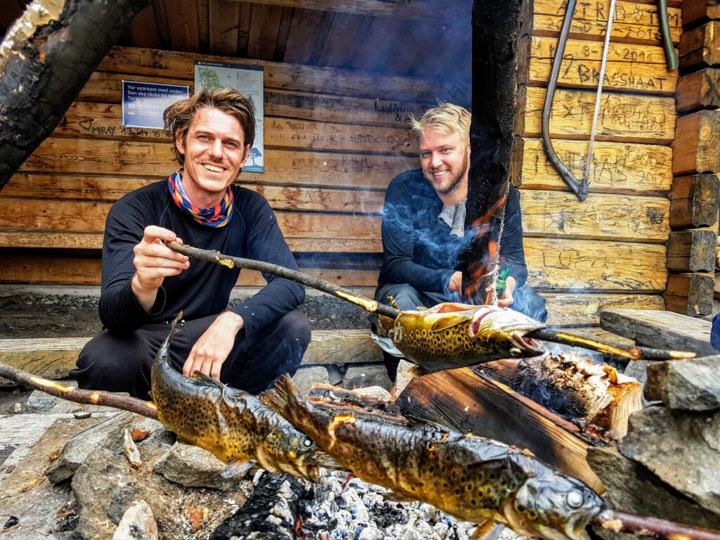
There is big chance to see beaver at svartälven. On dusk or dawn you will most likely see one and you will see traces along the river. The area has a big population of moose so there is always a good chance to spot one as well. You can fish if you buy a permit for a few SEK. Expect to get some pike or perch.
Passing through a smal community.
There is a road that more or less follows the river. Even though it very little traffic on the road you still get reminded of civilisation from time to time. There are some houses on the trail, especially at the lakes, and you will pass one smal community (Älvsjöhyttan). Here you can fill up your water reserve and visit the privy.
Short compilation from a 4 day tour on Svartälven.
The upside of this canoe trail is that it is close to Stockholm and in many ways easy accessible. There are some camping grounds on the trail and shelters to sleep in. There are a few lifts on the way but they are quite easy and if you have a canoe wagon then there is no problem at all since the lifting ports goes on gravel roads. All in all canoeing on Svartälven is a a fun end easy adventure that even beginners can enjoy. If you are a more experienced paddler or looking for a wilder experience then there might be better options.
When planing a wilderness adventure there is plenty of inspiration to find from national parks. In Sweden there is 30 parks to choose from. As always in Scandinavia, a good rule of thumb is the further north you go the more wilderness you get. Most of the national parks have a visitor center and most are easy accessible even though this vary greatly. All nature types are represented as national parks, from sea to forrest and mountains.
Sarek national park in the far north of Sweden is in the top of many peoples bucket list. It is remote and free from roads and man-made trails. It is also directly connected to three other nationalparks, Stora sjöfallet and Padjelanta in Sweden and Rago in Norway, which makes this one of the largest protected nature area in Europe.
All entry to the natural parks and visitor centers are free of charge but note that there might be some restrictions to the freedom to roam (allemansrätten). For example it can be that you are only allowed to camp in designated areas. For more information refer to nationalparksofsweden.se.
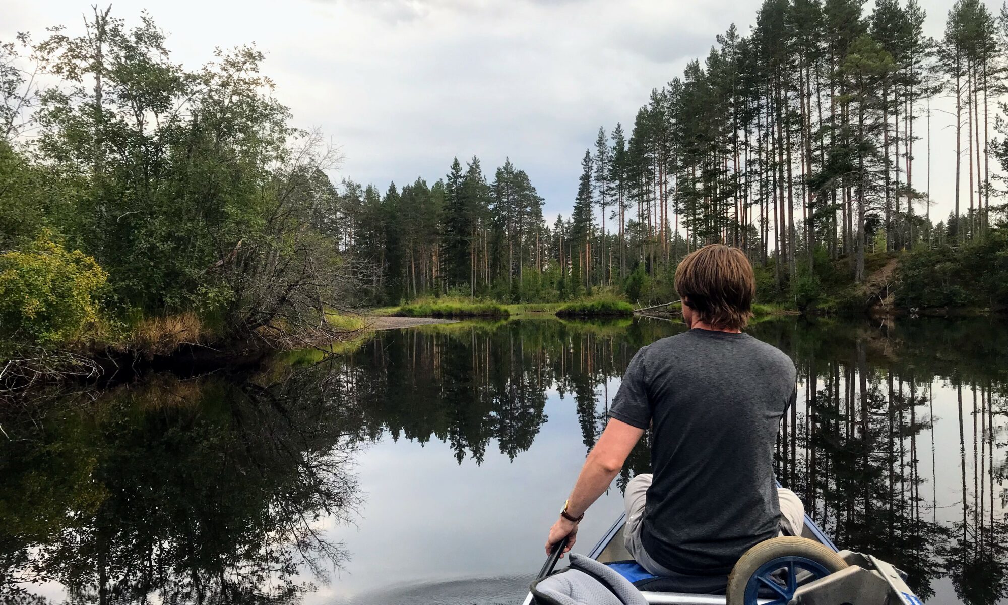
About 7 hours car ride from Stockholm is Rogen nature reserve with the lake Rogen at its center. There is plenty of opportunities to hike here but this is also a great place to explore by canoe. The trip described below became a 4 day tour, exploring Rogen and some of Femundsmarka on the Norwegian side.
The trip started at Käringsjön which you find at the end of a very bad road. This is the place where we hired our canoe. For more information look at Käringsjöns Facebook page.
Canoeing in Rogen Nature Reserve
Before you reach Rogen you have to navigate through all the little lakes. Around 7 places you have to lift your canoe from one lake to another to reach Rogen. These lifts can be quite hard and breathtaking so remember to not overpack your gear. The distance between the lakes are usually short but at some places the terrain is very hard to walk with a canoe on the top of your head. Worth mention is that it is not necessary to go all the way to the lake Rogen. We found that the best places where to stay in the small lakes.
mirror like lake
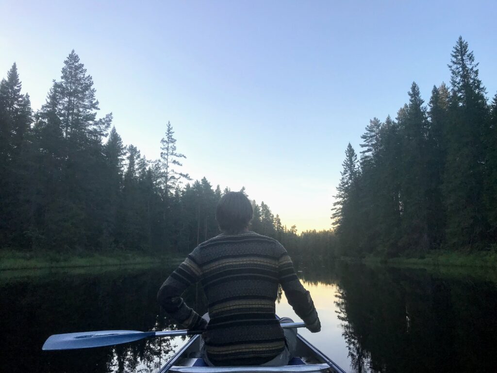
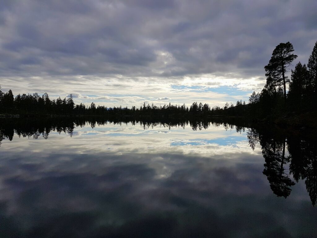
Our first day we got used to the canoe and to the lifting between lakes. The weather shifts very fast here and we were happy that we got some sun. The water is very clear and drinkable so water shortage is never a problem. We were surprised that it was so quiet here. The nature around here inhabits almost all of Sweden’s animals. The chance that you will encounter bear , wolverine or some other of Sweden’s big 5 is small though. Most of the time we didn’t hear any birds singing either which made the surroundings absolutely quiet at most times.
After 6 lifts with the canoe we made camp. The lakes was most of the time completely blank and mirrored the sky. After some food and evening fishing we went to bed and made ready for the next day when we where to reach Rogen.
Fresh Trout
The second day started with a short paddle to the last lifting point to reach Rogen. This lift was also the hardest. It is quite long and the terrain is made out of big rocks. Rogen can be a quite treacherous lake and the conditions can change very fast. It is very wind sensitive and it can easily form waves which makes it impossible to paddle an open canoe. We were lucky on our way towards Norway with the weather, even though it quickly went from blue sky to heavy rain. We made one coffestop on the way and reached the Norwegian border around 3 hours later.
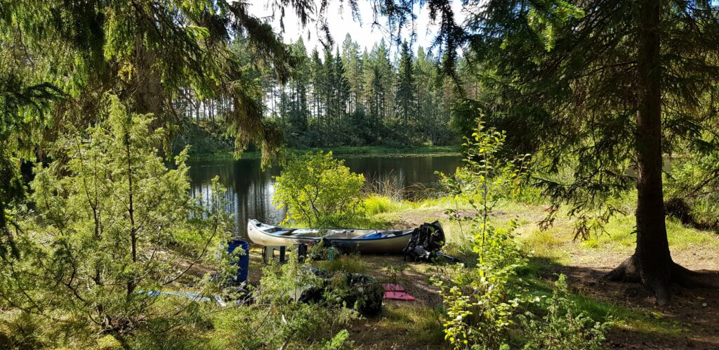
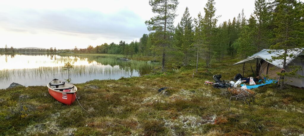
We were quite happy to leave the rather big lake Rogen and enter the smaller lake systems again that is more suitable for open canoes. There is no problem finding a good campsite here. More or less any spot is a good spot.
Campsite
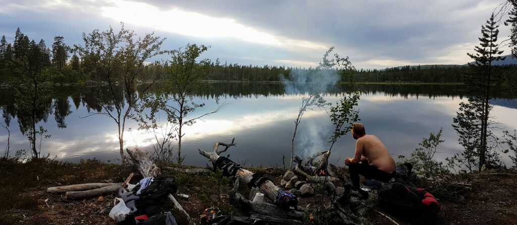
Third day started by heading back towards Sweden and crossing Rogen again. This time we had hard wind against us the entire time and at one point we thought we had to break since the waves started to become too big. We kept going and were very happy when we reached the end point for Rogen. Even though we took the same way going back it didn’t feel too much like we repeated ourself. The lake system is windy and there is so many coves and islands to explore. We found a nice campsite in a small lake and made a fire and swam in the clear, but cold water.
Campsite
Our last day was more or less just a travel day to get back to Kärringsjön. This time it was lots of wind even on the smal lakes so we were happy we had left Rogen behind us.
Rogen Map
The picture above shows the most common route, including the 7 lifts, to reach Rogen from Kärringsjön There is possible to reach Rogen i 2 lifts but the second becomes quite long.
Rogen and its surrounding lakes is really a great place for canoeing. The lifting between the lakes can be a bit hard at times but it is definitely not a showstopper. The wilderness feeling here is absolute. In the high season you will probably encounter other people but most of the time you have the feeling of being all alone. The surrounding is also suitable for hiking and there is trails here leading to Grövelsjön with cabins on the trails if you want to leave the tent at home.